Time-Zones-Map
Printable maps
Print
Download
Share
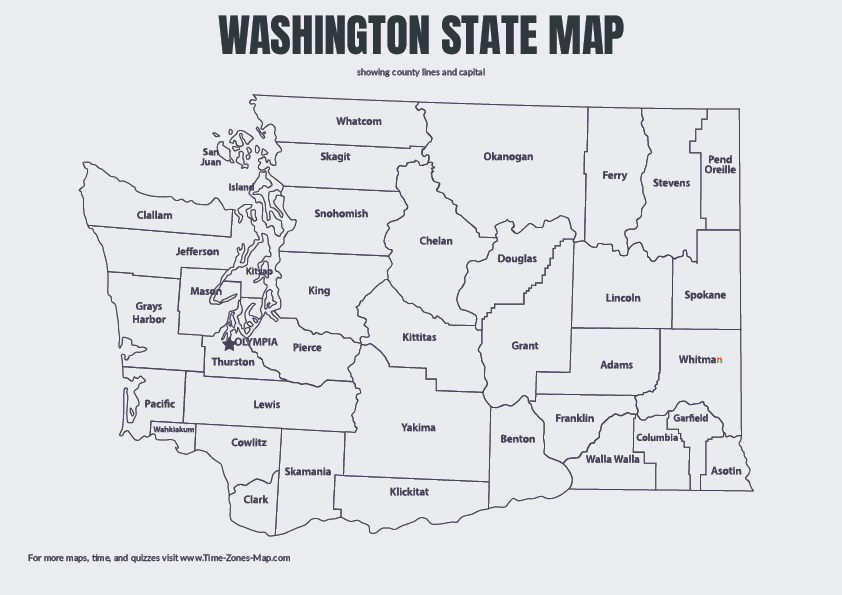
High resolution map of Washington State, perfect for printing or digital use. This detailed Washington county map includes county borders and capital. Use for your next lesson or craft project.
ADVERTISEMENT
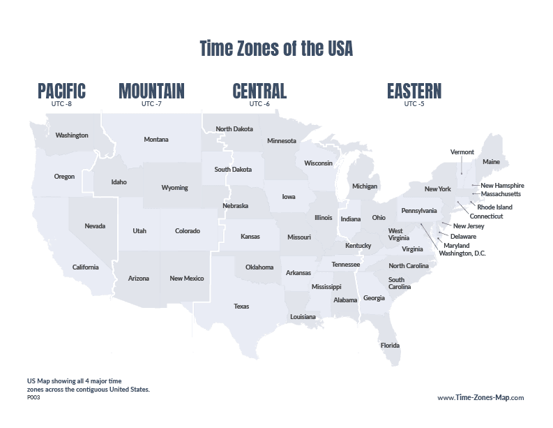
Download this detailed US Map with state names and in grayscale. Showcasing us map timezone border. Available as a high-resolution PNG or PDF.
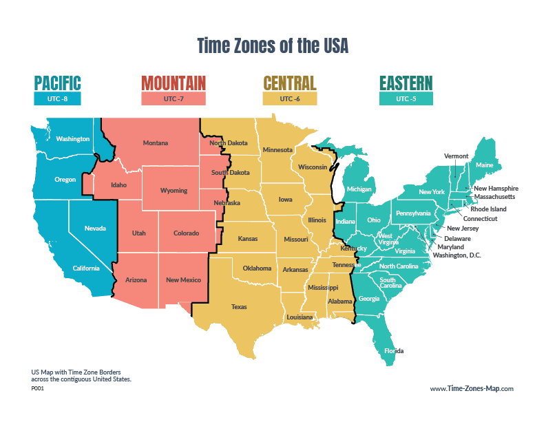
Explore time zones across the contiguous United States with this colorful, easy-to-read map. Each time zone is represented by a distinctive color, making it easy to identify time zone boundaries at a glance. The map includes state names and Coordinated…
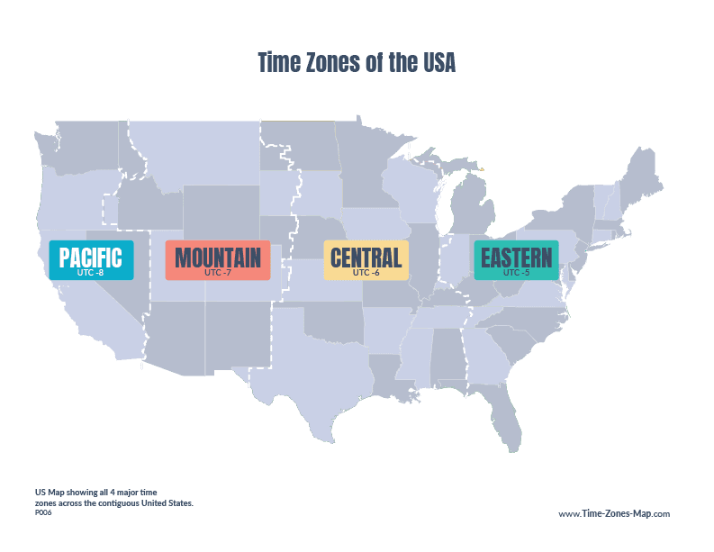
Download a simple printable map showing the four main U.S. time zones across the contiguous states. A handy reference for road trips and classrooms.
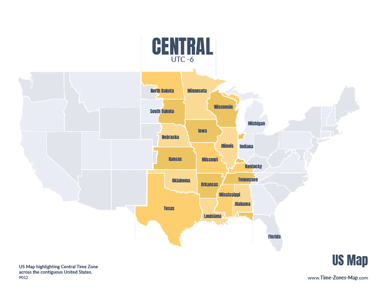
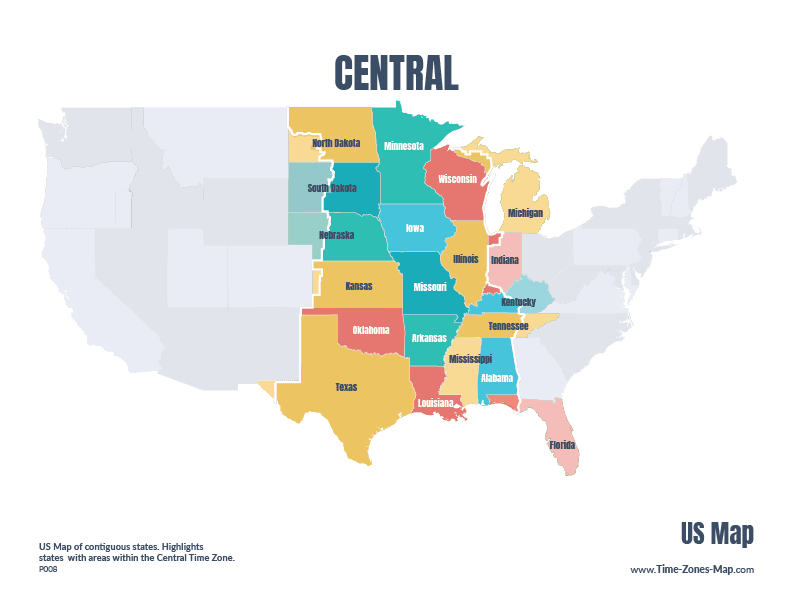
Download this great reference for states in the Central Time Zone of the United States. Be it for testing your knowledge or routing a trip this guide is for you
Download and print a simple U.S. map highlighting the states in the Central Time Zone. A perfect quick reference for travelers & teachers.